
Local Nature Recovery Strategies represent one of the most significant environmental planning requirements in recent years. With 48 local authorities across England required to develop these comprehensive strategies, the stakes are high – and the challenges are real.
LNRS blockers & challenges
Creating a Local Nature Recovery Strategy isn’t just about producing a document. It’s a fine balance of navigating complex stakeholder relationships, managing geospatial data, and conducting meaningful consultation on technical environmental priorities – all whilst meeting statutory obligations under the Environment Act 2021.
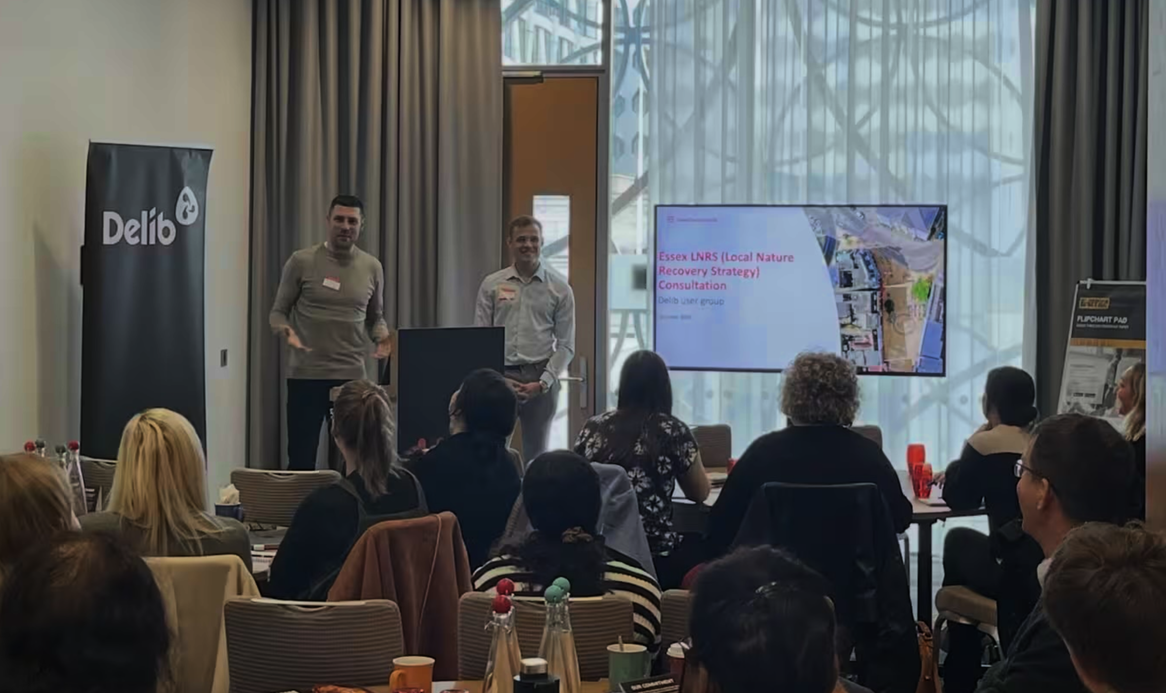
At a recent user group, we heard from Essex County Council who shared their positive experience of running an LNRS on Citizen Space. The activity even made it on to BBC News.
The presentation sparked immediate interest from other authorities in the room who were preparing to run their own LNRS consultations. Their questions revealed they were already anticipating the complexity ahead, asking about specific challenges and seeking practical advice.
The themes that emerged from their concerns reflected what authorities across England are grappling with:
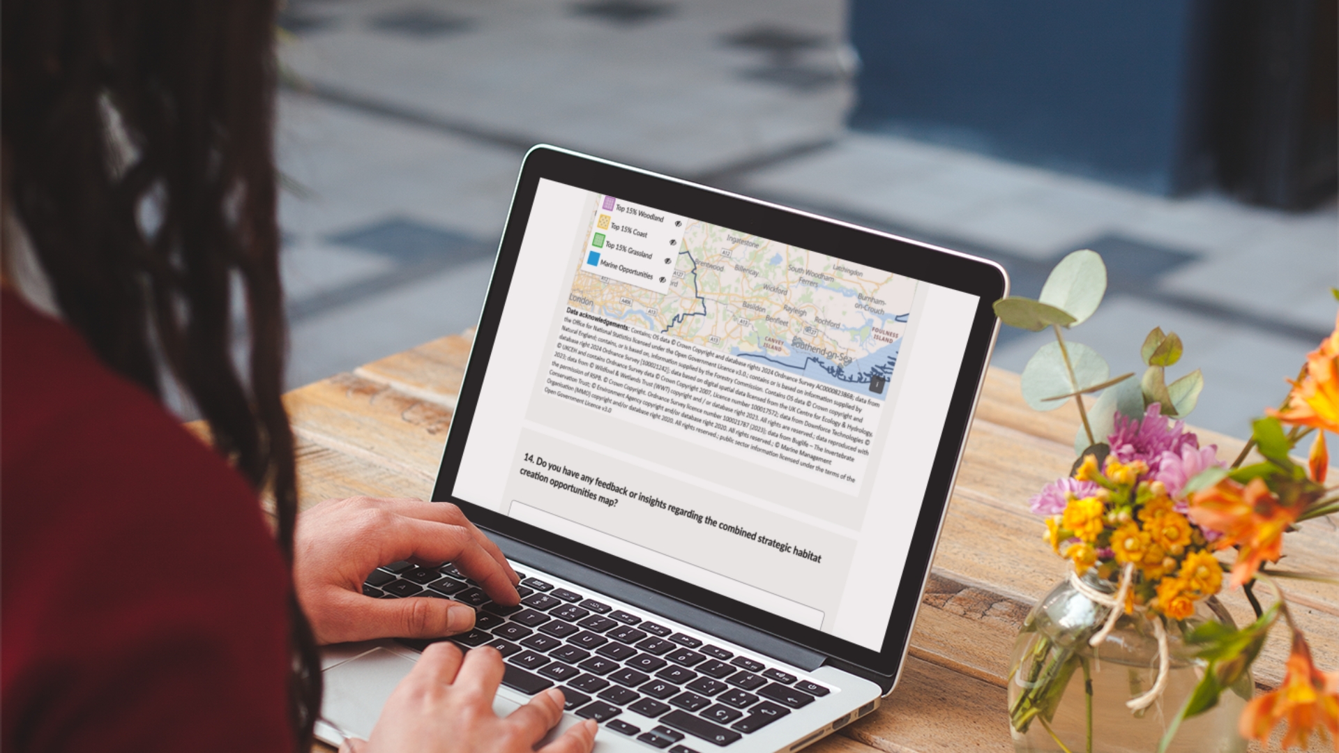
- Geospatial complexity: Managing large, multi-layered habitat maps that are difficult to display and interact with online
- Stakeholder diversity: Engaging everyone from residents to developers, NGOs to statutory consultees like Natural England and the Environment Agency
- Technical depth: Consulting on detailed biodiversity priorities and habitat mapping that require sophisticated presentation
- Time pressures: Balancing thoroughness with delivery deadlines
- Implementation decisions: Translating statutory requirements into practical consultation design and determining the most effective approach within the policy framework
Why UK local authorities choose Citizen Space for LNRS
Battle-tested by your peers
Citizen Space has powered many successful LNRS related activities across England, including Defra’s foundational 2021 consultation on Local Nature Recovery Strategy implementation – the very consultation that shaped how all 48 authorities would approach their LNRS work.
Local authorities using Citizen Space to run their LNRS have included:
- Essex County Council – Running their comprehensive public consultation on the Essex Local Nature Recovery Strategy
- Greater Manchester Combined Authority – Delivering their LNRS public consultation across the Greater Manchester region
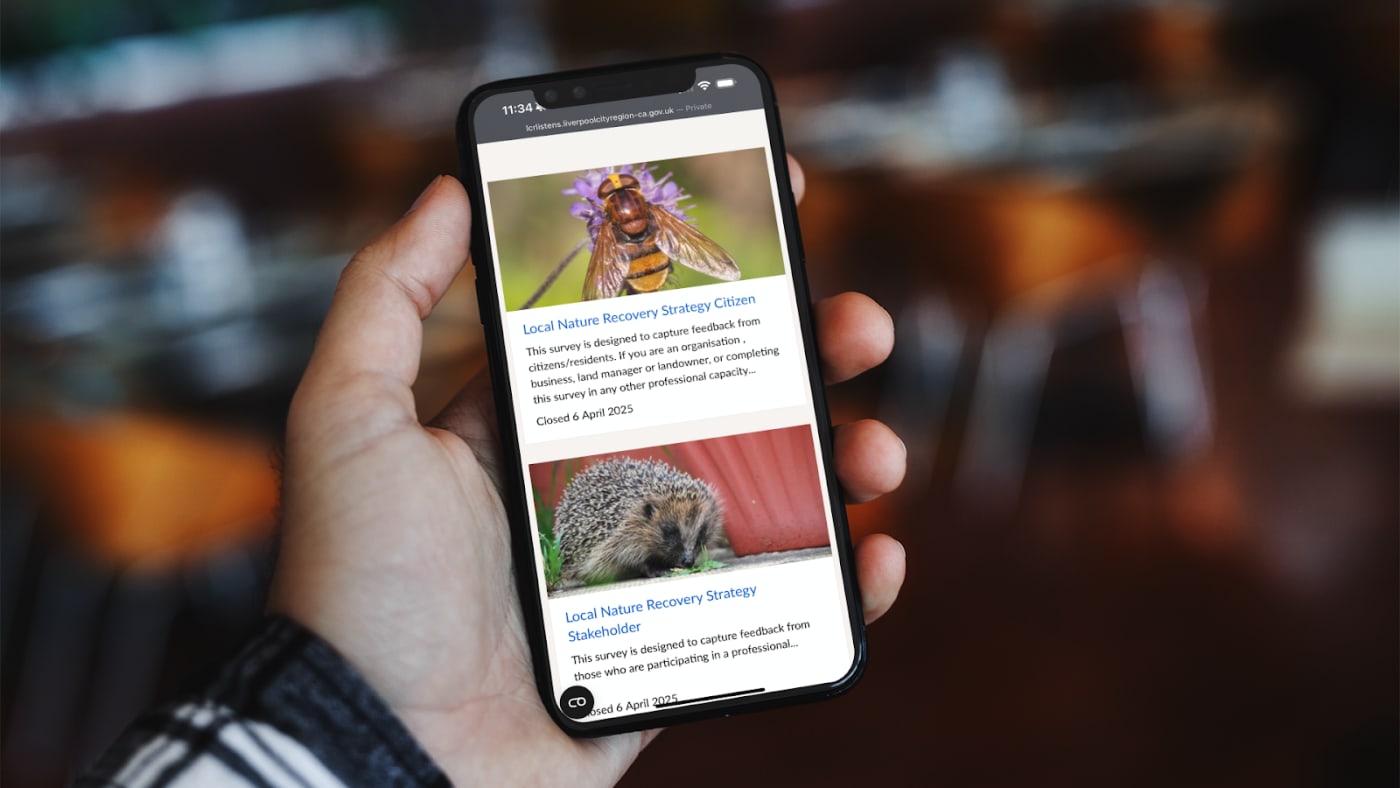
- Liverpool City Region Combined Authority – Conducting their LNRS consultation and other surveys and events from a dedicated landing page
- Somerset Council – Managing their Local Nature Recovery Strategy consultation for Somerset from pre consultation and beyond
- Buckinghamshire Council – Running their consultation on the draft Local Nature Discovery Strategy for Buckinghamshire and Milton Keynes
- Westmorland and Furness – Delivering the Cumbria Local Nature Recovery Strategy consultation
Sophisticated geospatial capabilities
Unlike generic survey tools, Citizen Space Geospatial is built for complex geographic consultation:
- Native map integration: Display multiple habitat and biodiversity layers without external workarounds
- Interactive consultation: Allow respondents to comment directly on specific geographic areas
- Large file handling: Manage substantial geospatial datasets with ease
- Visual accessibility: Present complex environmental data in ways that engage both technical and public audiences

Built-in statutory compliance
LNRS consultations must meet specific legal requirements. Citizen Space provides:
- Accessibility compliance: Built-in WCAG 2.2 accessibility ensures you meet statutory obligations without additional work
- Data security: Your consultation data stays in your own secure system
- Structured reporting: Data-first export capabilities that support the creation of your final strategy document
Streamlined stakeholder management
Managing the diverse LNRS audience – from statutory consultees to local communities – requires sophisticated engagement tools:
- A single source of information: Reach specific stakeholder groups with dedicated landing pages
- Professional presentation: Make complex information easily accessible with best in class design built into the platform
- Cross-referencing capability: Link multiple related activities for example surveys, and events within your broader LNRS consultation
Real results from real customers
Customers who have used Citizen Space for their LNRS consultations consistently report significant improvements in both process efficiency and stakeholder engagement.
Time savings have been particularly notable in the analysis phase, where the platform’s built-in tools for managing qualitative responses and geographic data have reduced the administrative burden that often extends project timelines. This efficiency gain is especially valuable given the typical 12-18 month LNRS development cycle and the pressure to meet statutory deadlines.
Public participation has also improved through more accessible and interactive consultation experiences. The platform’s ability to handle complex geospatial data whilst maintaining user-friendly interfaces has resulted in higher response rates and more meaningful engagement across diverse stakeholder groups.
Perhaps most importantly for busy council teams, using a proven consultation platform provides regulatory confidence. Authorities know their consultation processes meet Defra requirements without having to navigate compliance considerations independently. The reusable templates and processes developed during the first consultation cycle also provide future readiness for the next LNRS review in 3-10 years.
“To deliver a successful public consultation we needed to build a complex map functionality. Our Customer Success Manager ensured we found a technical solution but, more importantly, that it was a simple user journey. We were offered the support we needed to ensure we delivered a first class offer to citizens” – Liverpool City Region Combined Authority
More hands on deck, when you need it
Delivering an LNRS consultation isn’t just about having the right technology – it’s about having the right expertise. Our team understands the unique challenges of environmental consultation and can provide:
- Consultation design expertise: Leverage our experience with multiple LNRS projects to design effective consultation approaches
- Technical implementation support: Get hands-on help with complex geospatial data integration
- Process guidance: Benefit from our knowledge of what works across different authority types and contexts
The strategic advantage
An LNRS consultation represents a unique opportunity to shape nature recovery across your area whilst demonstrating environmental leadership. As one of only 48 authorities in England leading this pioneering work, you have the chance to create a lasting framework that will guide conservation efforts and attract funding for years to come. The strategies you develop will become the foundation for biodiversity net gain, influence local planning decisions, and help secure resources from future environmental schemes.
Our latest platform release brings new flexibility for complex LNRS workflows. The enhanced data API capabilities mean you can extract consultation data faster and integrate it directly into systems you already use, such as Power BI for advanced analysis and reporting. This is particularly valuable for LNRS projects where you need to combine consultation insights with other environmental datasets to produce your final strategy document.
The platform’s improved customisation capabilities also allow us to create bespoke solutions for authorities with particularly complex stakeholder engagement requirements or unique geographic challenges.
Citizen Space gives you the confidence to focus on what matters – developing a robust strategy that serves your local environment – rather than wrestling with consultation technology and compliance concerns.
Ready to get started?
Whether you’re just beginning your LNRS planning or looking to improve on previous consultation approaches, we’re ready to help. Our team has guided multiple authorities through successful LNRS consultations and can share specific insights relevant to your context.
Contact us today to discuss how Citizen Space can support your Local Nature Recovery Strategy consultation requirements. Let’s ensure your next environmental consultation sets the standard for meaningful, compliant, and effective public engagement.