
Up until now, the process of getting responses to geospatial questions has been mostly manual. Both from a customer perspective and from a staff perspective, being able to do that digitally solves a huge problem.
We released Citizen Space Geospatial in February after working hard on it for a year, and we’re extremely proud with the finished product. It has the potential to revolutionise place-based engagement and bring outdated planning processes into the digital age. Nevertheless, it’s easy to say all these things, but it’s our customers who will put it to the test – so actually seeing it in the wild for the first time is very exciting.
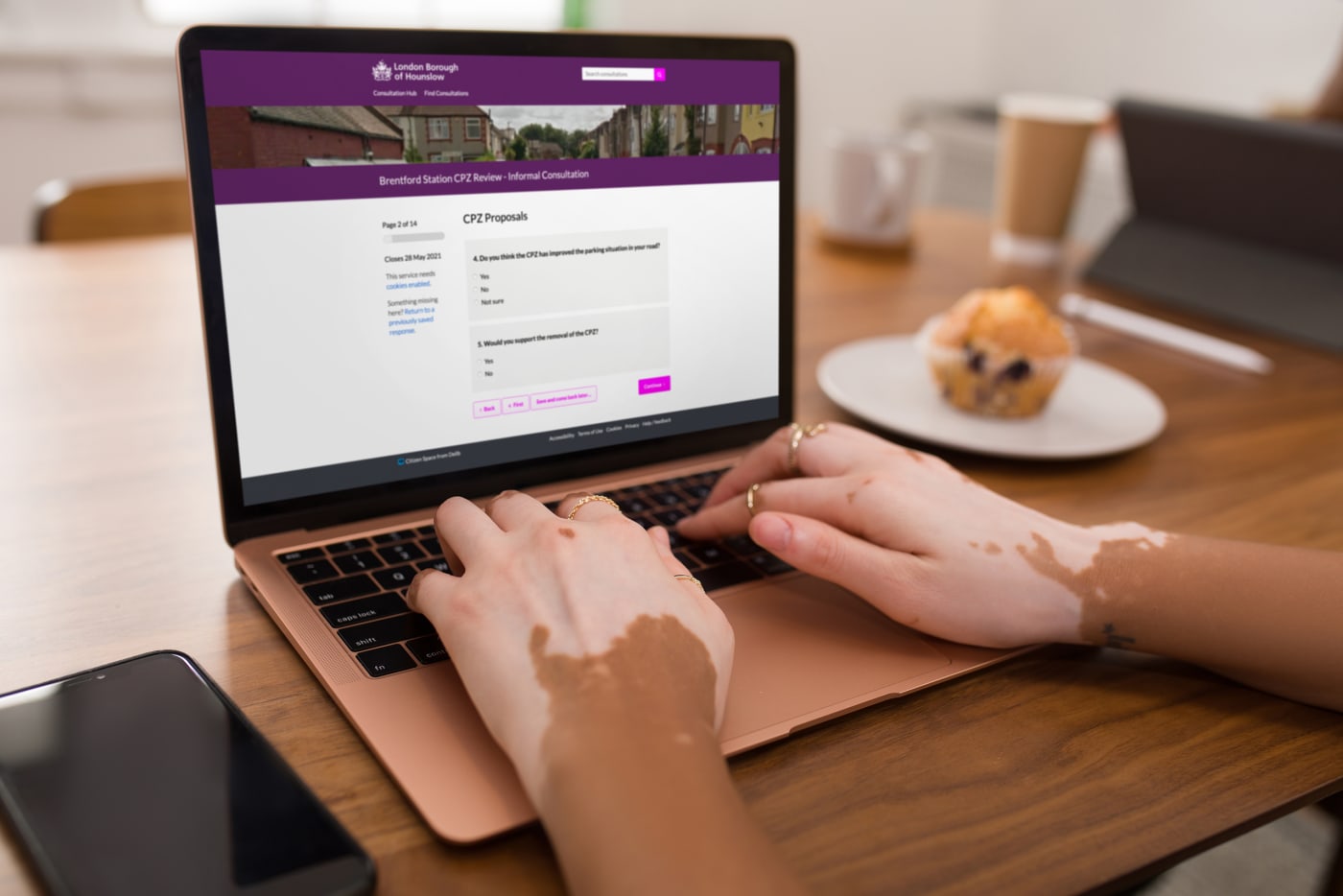
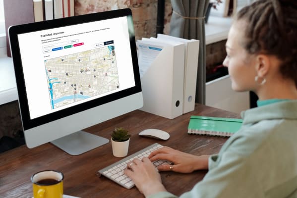
The London Borough of Hounslow was our first customer to publish a geospatial consultation: a comprehensive exercise from the transport planning team on changes to a controlled parking zone (CPZ), such as proposed locations for bicycle parking bays, car clubs and electric vehicle charging points.
I spoke to Laura James, who oversaw Hounslow’s procurement of Citizen Space three years ago and was involved in the decision to add Geospatial on to their subscription. She’s leaving the council to go and work for innovation charity Nesta but I managed to catch her for a chat before her final day. We talked about how Hounslow’s consultation and engagement has evolved since using Citizen Space, and her hopes and expectations for the impact that adding geospatial capability into the mix will have.
Hounslow’s consultation and engagement journey is a familiar story: different departments – who tend to be pretty siloed anyway in many councils – all had their own approach to consultation and engagement, which resulted in an inconsistent method of getting the public involved.
“We weren’t using a single system before we procured Citizen Space. There were a few different methods in play – standard survey tools, e-forms on our website – so there wasn’t a single coherent approach that staff and residents could get used to using. People who are fairly tech-savvy can more or less turn their hand to using any sort of software, but what’s good about Citizen Space is that it’s consistent. Once people have been on it a couple of times it feels familiar and they understand how it works, so for those users that aren’t so tech savvy it’s much easier to take part.”
Since then, Hounslow have published nearly 250 consultations on Citizen Space. About half of Hounslow’s consultation activity is planning and transport-related. So what will Citizen Space Geospatial change for them?
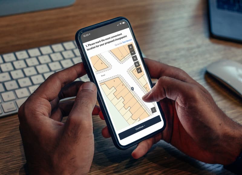
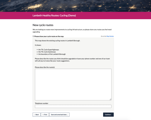
“Geospatial is, I think, going to particularly benefit our Transport and Planning teams. Quite a few of the things that they’ve done have had a static picture of a map that they’ve asked people to download, draw on and then re-upload, or send it in by post.
“Up until now a lot of the process around getting responses to geospatial questions has been manual. Both from a customer perspective and from a staff perspective, being able to do that digitally solves a huge time problem. It takes the pain out of those processes that we previously had to do manually, and gives us the ability to do them more quickly and in a more nuanced way.”
The Brentford CPZ consultation closed shortly before this article was published, so we can’t see the results just yet, but it’s already clear from seeing the quality of the consultation’s front end design how much of an improvement Geospatial is already making for the user experience. An older activity asked respondents to select a street name from a drop-down list and write comments about that area in a free text box below. It’s a marked difference from an interactive map which allows you to drop a pin on your area of concern – especially if you’re like me and can barely remember the name of the road you live on.
What’s good about Citizen Space is that it’s consistent. Once people have been on it a couple of times it feels familiar and they understand how it works, so for those users that aren’t so tech savvy it’s much easier to take part.
We’ll await Hounslow’s feedback on the reporting process once they’ve done it, but Laura reckons it will have a huge impact.
“The work you’ve done on the geospatial reporting tools will also be really useful. It allows you to process the results in a way that you probably wouldn’t be able to, at least not easily, if you were working with PDFs and bits of paper.
“If you’ve got a particular consultation you’re asking people to complete and you end up receiving 60 pieces of paper in the post – you’d have to scan and upload them and manually input the data so that you could see what they all look like on a map, whereas in Geo you’ve got them all there and they’re already linked to data and peoples’ other responses. And with paper, if you want to just look at a single postcode, or see where there are clusters of responses in conjunction with other data – to analyse it in that way would be much more complicated and you wouldn’t be able to make the same level of sense out of it. Citizen Space Geospatial gives you data that’s all linked already and you can filter it however you like to get those deeper insights.”

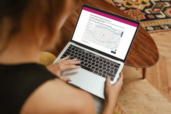
For context, one of Citizen Space Geospatial’s USPs is its sophisticated reporting and analysis capability. The data that’s collected is displayed in an interactive map which can be easily exported to a GIS for deeper spatial analysis or saved as an image and inserted into reports. Admins can view geospatial responses by area, respondent type or demographic.
This means responses don’t just look good – they convert into valuable data that can give planners and other public officers unique insights, enabling more informed decision-making and better public feedback. Our hope, as with all our tools, is that Citizen Space Geospatial will add a level of transparency and legitimacy to planning processes and other place-based engagements, and discourage democratic activities that are performative or gimmicky. It was nice to hear that Laura thinks the same.
“Citizen Space is – it’s ethical. You guys really care about accessibility, you care about data ethics; you really think through all of the stuff that matters to a council. It’s not just engagement for engagement’s sake; it’s realising that people need to be able to do something with the data that is generated and close the loop.”
The ability for residents to go to the same place to find a consultation, other activities they might be interested in, results of the ones that they’ve taken part in, it makes the process really open and it creates a feedback loop which shows residents that actually they’re not taking part in something just for the sake of it, they’re taking part in something meaningful that has actually led to an impact on whatever the proposals were.”
“Citizen Space – it’s ethical. It’s not just engagement for engagement’s sake; it’s realising that people need to be able to do something with the data that is generated and close the loop.”
I’m conscious that Laura has an awful lot to get done in the next couple of days, so it’s time to wrap up the call. Before we sign off, I ask her if she’s got any final comments or shoutouts.
“The one other thing I would like to say is that the support that we get from Delib in using Citizen Space is always amazing. If we have a problem, it’s always resolved super quickly. If we’re not sure how to do something, we need some help trying to figure out how something should look, Katherine and other members of the support team are always willing to help and to talk things through. You’re not just buying a product when you get Citizen Space, you’re buying a support network. I like all the User Group events that give you an opportunity to speak to your peers. I don’t think a lot of service providers would necessarily do all of that, so yes, as an organisation Delib’s been really great to work with, not just Citizen Space as a product.”
Huge thanks to Laura for finding some time in her busy last week to speak to me, and best of luck on her new adventure. We can’t wait to see how the team at Hounslow use Citizen Space Geospatial in the coming months.
Stay tuned for more updates – if you’re interested in hearing more about Citizen Space Geospatial, make sure you sign up to our newsletter.
Revolutionary place-based engagement with Citizen Space Geospatial
Include maps and geospatial data throughout your consultation and engagement activities.
Citizen Space Geospatial solves a lot of problems for a lot of people. But who defines those problems and how do we solve them?

Citizen Space Geospatial was designed based on user research involving over 20 government organisations. You can read about the user research journey here.
How did we go about building Citizen Space Geospatial? What were the challenges? You can read about the engineering journey here.
How can geospatial tools include people who, for whichever reason, can’t use a map? Read about how we designed for accessibility and inclusion.
What is geospatial data? Why is it important for democracy, consultation and engagement activities? Read a detailed overview.
To find out more about Citizen Space Geospatial book a demo and we’ll walk you through it.
