
At the end of last year we witnessed the world come together to discuss climate change policy at the UN’s annual COP conference in Dubai.
Transport was a big topic of conversation, as policymakers looked for ways to decarbonise a highly-polluting sector (95% of the world’s transport energy still comes from fossil fuels). Now, the challenge is to move from statements to action — and this is where we think Geospatial software both saves time and improves the quality of decision-making.
Geospatial mapping makes the process of taking part in democratic exercises simple and engaging. From stakeholders who no longer have to draw on a printed map and upload it, to road users who want a better way to comment on travel routes, our accessible and intuitive platform allows the public to meaningfully share their opinions on decisions that affect the areas they care about most.
So, with COP28 firmly in the rearview mirror but climate still firmly on the agenda we’d like to round up some of the great ways policymakers are using Citizen Space Geospatial to create transport plans that are both joined-up with international agreements and popular with local citizens.
City of York Council
Lower emissions. Healthier living. Less congestion.
There are so many reasons why local councils would want to promote active travel as an alternative to car journeys. However, it’s not as easy as painting a few cycle lanes and being done with it.
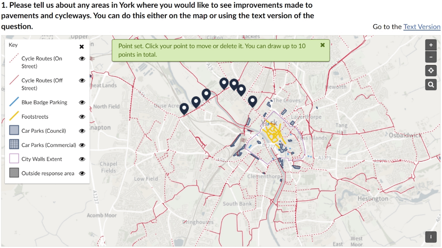
City of York Council recognise that a holistic approach is necessary and launched ‘Our Big Transport Conversation’ to gather public feedback. In a historic and bustling city, it’s especially important to hear everyone’s views, and their survey encourages responses from commuters, residents, businesses, and tourists.
Transport policies have far-reaching effects, and York’s plan covers everything from public transport, road networks, streetworks, and air pollution, to considerations like freight and logistics. Using Citizen Space Geospatial, their proposals were brought to life on draft network maps — with contextual colour-coded information that shows both existing infrastructure and planned changes.
Geospatial mapping makes it easier for people to understand the proposals at a quick glance. You don’t have to be familiar with the names of every road and place when you have a map that tells you everything.
And if you want to join the conversation, it’s as simple as leaving a comment as a “pin” on the map, where you can explain why you support or oppose that section of the proposal. Alternatively, you could suggest your own idea — like drawing a line on the map — which lowers the barrier of entry for citizens to have their voices heard in local decision making.

Essex County Council
Essex County Council also see active travel as key to their transport plans for the future and are deliberating on the best places for local walking and cycling routes.
They want to create infrastructure that promotes carbon-free journeys for people across all walks of life. Take the example of school drop-off: when you have children walking or cycling to school, it doesn’t just reduce traffic and air pollution, it also improves physical health and educational outcomes.
To achieve this, the council are using Citizen Space to engage with their constituents and learn something from their local knowledge. It might sound obvious, but local residents really do understand where the gaps are in the existing travel network better than anyone.
Geospatial does two things to help this process along. Firstly, it informs residents of proposals, with interactive maps that clearly illustrate each route. Second, it invites their feedback. The survey allows respondents to draw “desire lines” for walking and cycling routes, which provides invaluable data for local planners.
For example, it’s easier to conduct ‘origin-destination analysis’ and work out which areas have the highest demand for new routes. The result is that development funds can be spent in the best possible way for everyone’s needs.
The future of placed-based democracy needs to be more transparent, providing the public with relevant information and more control over decisions that affect them every day. Geospatial provides openness, transparency and data that bridges the gap between the public and policymakers.
Zooming out to the global level, two-thirds of UNFCCC countries already have some kind of active travel policy in place; but it’s technology like Citizen Space Geospatial that gives policymakers and residents a birds-eye view of what’s really happening in their area.
