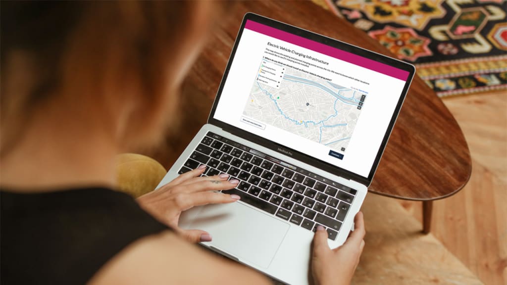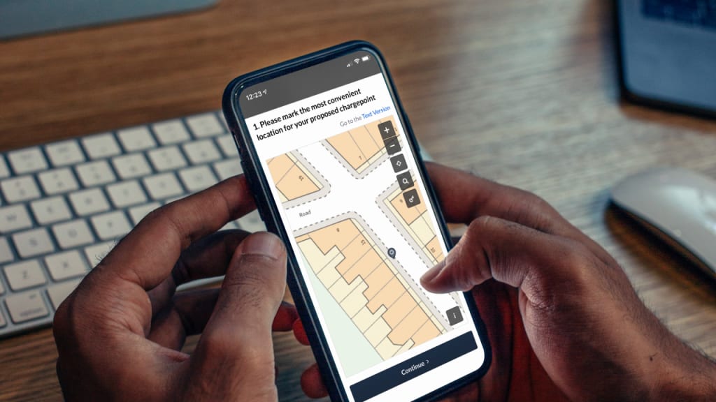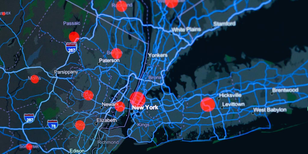
Community mapping is a way of combining local knowledge with geospatial data in order to create new and important place-based insights. In recent years, mapping activities have become increasingly common as an engagement tool and as part of consultation processes across sectors. The following article discusses what community mapping is and how to use it effectively.
What is Community Mapping?

Community mapping, also known as participatory mapping, is a valuable citizen engagement activity. It is a process of creating maps alongside citizens that reflect their lived experiences, priorities and local insights. The activity engages community members and citizens in a visual dialogue using geospatial data, allowing information to be contextualised in familiar spaces.
Community mapping can be used to provide information to citizens, or it can be used by facilitators to gain the perspective of citizens. Often, a community mapping exercise will do both.
How Community Mapping is Used
Usually an activity will start by giving some context. For example, facilitators may state that there are a certain number of police available at any given time within a specific geographic area that is demonstrated using mapping technology. Then, participants would be invited to provide their own views spatially, for instance by showing on the map where they think police should focus their patrols. This may include highlighting areas they’ve felt uncomfortable in the past, or that have a certain reputation.
This is an example of issue-based mapping, where the data is used to show areas that have a particular need. Mapping can also be used more broadly, inviting opportunities for creativity. For example, inviting a community to mark out areas for housing, open spaces, or public buildings.
While the term community mapping can be used interchangeably with placemaking, it generally places a greater emphasis on inclusivity. Community mapping activities often prioritise those with a particular lived experience or relationship to an area, in order to access viewpoints that may be excluded in a traditional consultation.
Using Geospatial Data

Geospatial data or GIS data is technically any information that describes the relationship between a particular object or location and the earth. For these purposes, it describes data that can be used to generate any kind of map. Geospatial data goes beyond just showing the lay of the land however. It can be used to represent anything from traffic density, to flood zones, to population demographics. In recent years, access to good quality geospatial data has become vital to effective public service delivery.
In the UK, access to high-quality mapping data has been significantly improved by the creation of the Geospatial Commission and the implementation of the Public Sector Geospatial Agreement (PSGA), which came into effect in 2020. Delivered by Ordnance Survey, this agreement allows any public sector organisation to access reliable geospatial data covering a range of issues that is free at the point of use. This data is used to provide various public services, including emergency responses, planning and land development.
The Geospatial Commission has helped to co-ordinate the use of geospatial data across government. Increasing the availability and quality of data has helped to create more innovative govtech platforms, which can now use existing geospatial data to create more inclusive and comprehensive citizen engagement activities.
Community mapping can now use this geospatial data to help visualise issues in a way that written text often cannot. Public bodies can use mapping platforms to show:
- Where new housing and infrastructural developments are being proposed.
- Access of specific areas to public services, such as public transport routes or proximity to local amenities.
- Local environmental risks, such as flood zones or air pollution levels.
- Crime levels by area, or level of socioeconomic deprivation.
When participants take part in a community mapping activity, they are then providing new geospatial data themselves. Whether that’s identifying problem zones, demonstrating desires, or offering alternative planning proposals. All of this adds to the existing data pool that can then be used by local and central governments to improve public service provision. Used properly, geospatial data adds a new dimension to the communication between citizens and public bodies.
The Benefits of Using Geospatial Data for Community Mapping

Community mapping has been a useful innovation within citizen and community engagement in recent years. There are a number of benefits when engaging communities using geospatial data. The ability to both present information and gather input spatially has the potential to improve the quality of data received through an engagement activity. Other benefits include:
- Providing a visual context for both sides: Seeing proposals contextualised spatially can make them easier to understand, allowing people to grasp what is happening and how they might be impacted without having to parse dense policy documents. It also allows people to express their views in a way that is simple for facilitators to understand.
- Accessing information that may otherwise not surface: Some information can only really be described spatially. Specific sites, routes or zones that may be identified using local knowledge would be very difficult to describe through any other interface.
- Improving inclusivity and accessibility: As mapping is a more intuitive way of understanding information for many, it can be very useful in addressing existing barriers to participation. This is particularly true when used alongside more traditional engagement activities, allowing a range of people to take part in the manner they are most comfortable with.
- Greater trust and transparency: Community mapping demonstrates a real effort on the part of the public bodies in question to give visibility to proposals and plans and gather input. This transparency builds trust in the process, and can create a more positive relationship with the public.
- Highlight local strengths through asset mapping: Community asset mapping helps identify existing community resources, like public spaces, that can be leveraged to support local initiatives and promote sustainable development.
As geospatial data becomes more widely available, citizens increasingly expect to see it reflected in engagement processes. In the next several years, community mapping will likely become not just a useful tool, but a necessary part of any engagement activity or consultation.
How to Use Community Mapping for Public Consultations

While community mapping can be a worthwhile standalone engagement activity, it is increasingly used as part of a wider consultation process. When used effectively, participatory mapping can be used to make public consultations more accessible. It can also be used to gather more meaningful data in order to inform spatially-aware policies.
Setting up a Community Mapping Exercise
The first step to using community mapping as part of a public consultation is to establish where and how spatial feedback would be most useful. This could be the entirety of the consultation, or it could be just an element of it. This will largely depend on the purpose of the public consultation.
Once the purpose and scope of the mapping exercise is clear, it is essential to have a consultation platform that is able to support geospatial data inputs. A purpose-built govtech platform should include mapping functionality, allowing facilitators to overlay contextual data layers. As mentioned above, much of this data is freely available from Ordnance Survey.
When setting up a mapping exercise for a consultation, it is important to plan ahead and follow consultation principles. All information provided should be clear and easy to understand, including accessible instructions for participants.
Collecting Feedback from Community Mapping
How respondents can interact with the maps provided will vary between consultations. They may be asked to draw boundaries, annotate specific routes or highlight areas of concern. This data can then be aggregated using inbuilt geospatial analysis tools, helping facilitators to identify common themes.
It is rare for geospatial data alone to be used during a consultation, but instead is used together with other quantitative and qualitative data inputs. This provides a more detailed and richer understanding of community perspectives.
Ensuring Mapping Activities are Accessible
Like any element of a public consultation, mapping activities must be both accessible and inclusive. This is particularly important given community mapping is often used to engage communities that may otherwise not interact with a consultation process. Examples of accessibility in this context include:
- Ensuring the mapping interface works with assistive technologies.
- Using plain language throughout (and making sure text is screen-reader friendly, even when embedded within maps).
- Providing alternatives where feasible, such as paper maps and in-person workshops.
Examples of Community Mapping in Public Consultations

Community mapping can be used as part of a wide range of consultations. However, there are certain consultations in which mapping activities are more common. Here are some examples of how mapping can improve these types of consultations:
Public Transport
Participatory geospatial mapping of public transport infrastructure can be used to show where it isn’t working. That may mean showing areas where there aren’t enough bus or tram stops. It could mean showing where routes are indirect or inefficient, for example routes that regularly spend a great deal of time stuck in rush-hour traffic. It could be used to flag gaps, where people are having to commute long distances on foot to connect two existing routes.
These insights help planners to understand demand in a way that simply stating that there aren’t enough buses could not. It can be useful for showing policy-makers why people may not use public transport, and how infrastructure improvements could change that. Spatial data is very helpful for all transport related consultations.
Crime and Public Safety
Maps can also help prevent crime and improve existing policing strategies, by allowing residents to easily indicate areas that they may have witnessed criminal behaviour or felt unsafe. It can be used to show areas that are poorly lit, or roads where there is regular speeding. Spatial data can be used by police forces to deploy limited manpower in a way that maximises efficiency and reassures the public.
Healthcare
Although healthcare may not seem to be an obvious candidate for a mapping activity, it is an increasingly relevant area for spatial consultation. Participants can use geospatial data to show where they feel services are missing or difficult to access. They may highlight areas where there is long travel times to GPs or pharmacies, or where those areas are not easily accessible via public transport. It could be used to show where practices are overcrowded.
In the UK, where you live has a large bearing on the standard of healthcare many people receive. It is therefore important to use spatial data when considering how to improve healthcare services.
Citizen Space is the go-to platform for connecting governments, developers, and citizens. If you’d like to learn more about how our software can be used for community mapping, book a free demo and we’ll walk you through it.
Sign up for the Delib newsletter here to get relevant updates posted to your email inbox.